I decided to put together a little vintage family photo album over on my flickr account. I will post here when I update over there.
I decided to start with this photo, because at the end of this past summer (2012) I was
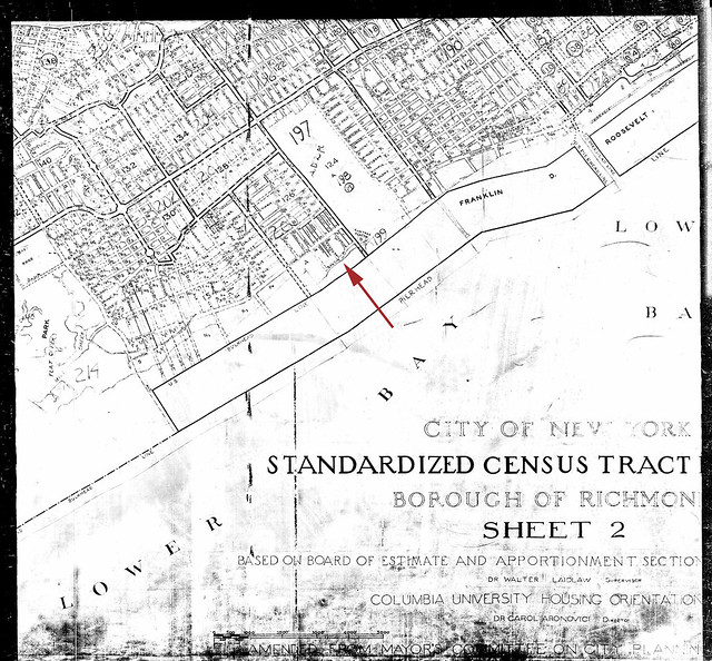
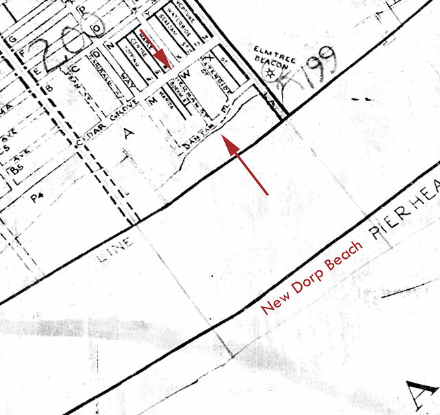
driving myself crazy obsessed with looking for a map that showed Herman Street in New Dorp Beach, Staten Island. The datestamp on my downloaded copy of the photo of the map is August 20, 2012 -- this is the date I downloaded the photo to my PC.
Now you might be asking yourself why I couldn't just go to googlemaps and find this street. The reason is -- this street -- along with a few others surrounding it in this section of New Dorp Beach -- was "demapped" during the Robert Moses project many years ago. Nothing was ever built in this section of New Dorp Beach again.
After I found this map, my
obsession subsided. And then, on October 29, 2012, Hurricane Sandy hit right at this very spot in New Dorp Beach, Staten Island.
Click on map to enlarge:

Closeup of map (click on map to enlarge):

Here's a link to an even older map of this area (from 1907)
Click here
And here's a link to a photo of the ruins of some buildings that existed here in the 1907 photo. These buildings were already gone before I spent my early childhood summers on this beach. I do remember, during those summers, this area had white silky dry sand that sparkled and you could only see the very tips of some of the cement pieces in this photo. We were told not to go "over there" because it was dangerous. Now, only many years later, I can see what was under all that pretty sand.
Click here
In this photo you can see the remnants of the long pier shown in the 1907 map. That is the section of the beach that we frequented in my early childhood. You could walk away from the water and off the beach right onto Herman Street.
Click here


No comments:
Post a Comment
Thanks for taking the time to leave a response. We really love hearing from you! :)